News Update in Palo Leyte (November 8, 2013)
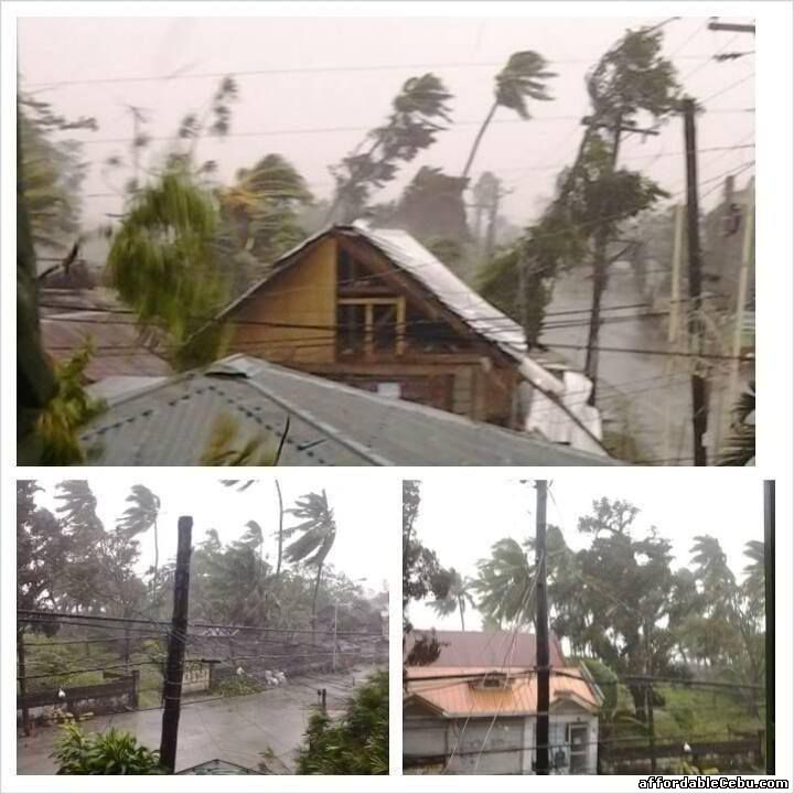
Typhoon Yolanda crosses Tacloban City, Leyte
Typhoon Yolanda in Ormoc City, Leyte
Pictures

Ormoc City, Leyte
Linao, Ormoc City
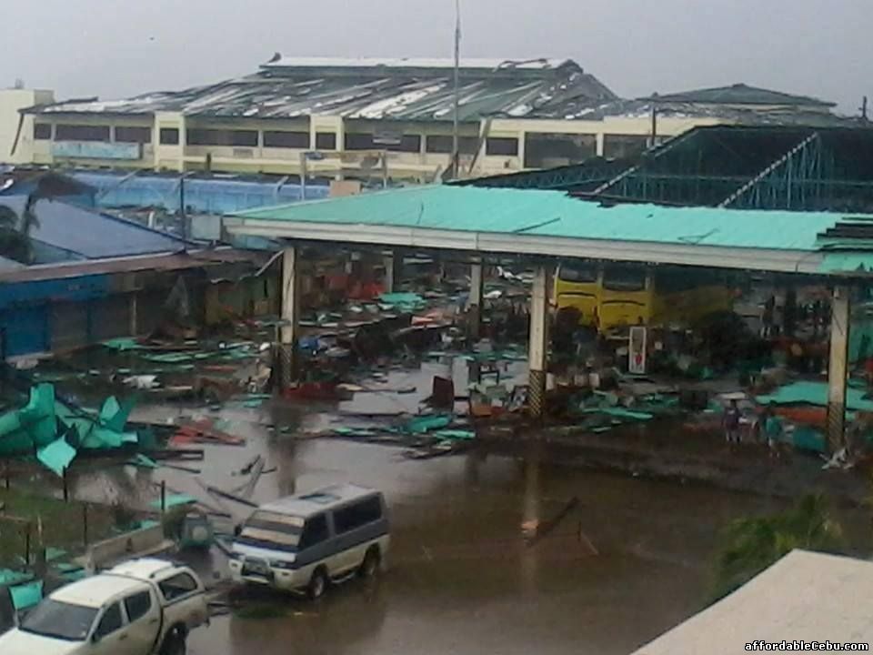
Ormoc City Plaza and Terminal
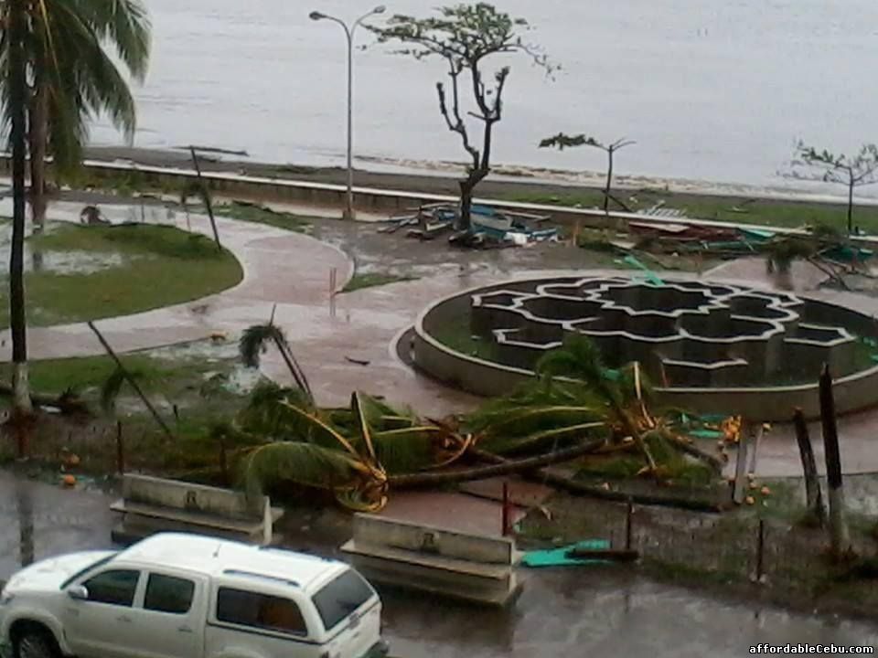
Ormoc City Plaza
10:00 am (November 7, 2013) Update
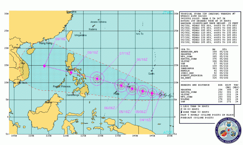
Super-typhoon Yolanda located at 637 km East of Hinatuan, Surigao del Sur. It maintains its strength of 215kps sustained winds near the center and 250kph gustiness. It moves west northwest at 30kph.
Public storm signal has been raised to the following areas:
- Signal No. 3
- Eastern Samar, Samar, Leyte and Southern Leyte, Siargao Island, Dinagat Province
- Signal No. 2
- Sorsogon and Masbate including Ticao Island, Northern Samar, Biliran Province, Bantayan and Camotes Islands, Northern Cebu including Cebu City and Bohol, Surigao del Norte, Camiguin, Surigao del Sur, and Agusan del Norte
- Signal No. 1
- Camarines Norte, Camarines Sur, Catanduanes, Albay, Mindoro Provinces, Burias Island, Romblon, Marinduque, Calamian Group of Island and Sourhtern Quezon, Aklan, Capiz, Iloilo, Antique, Guimaras, Negros Occidental and Oriental, rest of Cebu and Siquijor, Misamis Oriental and Agusan del Sur
Super Typhoon Yolanda is the 24th typhoon to enter in the Philippine area of responsibility (PAR).
Super-typhoon is defined as one with maximum winds greater than 200kph.
PAGASA (Philippine Atmospheric, Geophysical & Astronomical Services Administration) forecasts that the super-typhoon will make a landfall over Eastern Visayas and Bicol as what you can see in the map above. It will also affect the provinces in Samar, MIMAROPA (Mindoro Oriental, Mindoro Occidental, Marinduque, Romblon and Palawan.
Residents in the affected areas are advised to stay alert, be prepared and listen or read the latest updates of the coming Super-Typhoon.
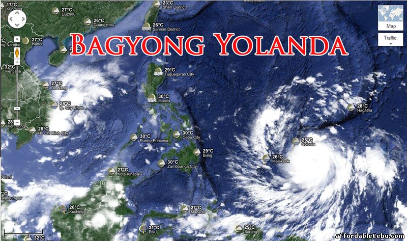
Bagyong Yolanda as of 7:00pm (November 6, 2013):
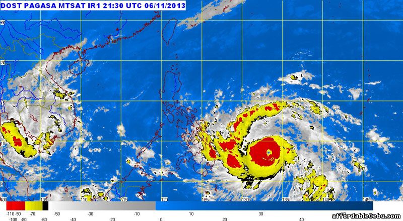
Typhoon Yolanda as of 5:30am (November 7, 2013):
According to PAGASA, at 4am today, the eye of Yolanda typhoon was located at 822 km east of Hinatuan, Surigao del Sur with maximum sustained winds of 215 kph near the center and gustiness of up to 250 kph. It is forecast to move west northwest at 30 kph.
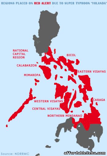
Affected areas which are placed on red alert due to Super Typhoon Yolanda:
This post will be updated with pictures and videos as soon as new updates are gathered. Bookmark this page for new updates.
- https://www.affordablecebu.com/